Emerging forecasts increasingly suggest the developing El Niño in the tropical Pacific Ocean may rank among the strongest on record, raising concerns about potential record-breaking global temperatures and significant humanitarian consequences.
Rapid warming has been observed in sections of the Pacific, with recent data indicating sea surface temperatures approximately 0.5°C above normal—a key threshold for signifying the onset of El Niño, a natural warming phenomenon in the Pacific.
The phenomenon is anticipated to intensify in the coming months, potentially reaching its peak as a very strong, or “super,” El Niño in the autumn.
Scientists are expressing concern over the potential impacts on global weather patterns, including the heightened probability of 2027 becoming the warmest year ever recorded.
In its latest outlook, the National Oceanographic and Atmospheric Administration (NOAA) projects that El Niño will commence within the current month.
NOAA has also increased its confidence level, estimating a two-in-three chance that the El Niño event will be strong or very strong by this winter.
The pace of warming observed in the tropical Pacific over the past few weeks has been notably rapid.
Nathanial Johnson, a meteorologist at NOAA, described the current trajectory as a “rare occurrence,” should it persist—transitioning from the La Niña cooling pattern experienced in winter to a potentially strong El Niño within a single year.
The Bureau of Meteorology (BoM) in Australia also employs a stricter criterion for forecasting El Niño, requiring sea surface temperatures in the tropical Pacific to exceed 0.8°C above average.
Additionally, BoM monitors for indications of reversed trade winds in the western Pacific, signaling that the warming ocean is beginning to influence the atmosphere.
Historically, spring forecasts of El Niño have been less reliable, but forecasters have expressed greater confidence this year.
The graph illustrates the temperature increase above the long-term average in a specific region of the Pacific used to determine the onset of El Niño. The lines represent an average derived from various models used by different forecasting agencies.
Source: BoM/ECMWF/NOAA
While El Niño develops across the tropical Pacific, forecasters focus on a particular region known as Niño3.4, tracking the three-month average of sea surface temperature compared to the long-term average.
A strong, or “super,” El Niño is indicated when this average surpasses 1.5°C.
Forecasts from the European Centre for Medium-Range Weather Forecasts (ECMWF), NOAA, and BoM are largely consistent in their projections.
The latest prediction from ECMWF suggests that more than half of its forecast models indicate a temperature increase exceeding 2.5°C by the autumn.
Johnson stated that anything exceeding this level would constitute a “historically strong event.”
BoM forecasts also confidently indicate the potential for a very strong El Niño to develop later this year.
Some forecast data even suggests the temperature rise could exceed 3°C, surpassing the current known peak of 2.7°C recorded in 1877.
It is important to note that the 1877 event occurred in a very different era with limited observations, resulting in significant uncertainty in the reported temperature.
That El Niño lasted approximately 18 months and triggered a catastrophic global climate event, causing extreme drought and widespread famine across Asia, Brazil, and Africa, resulting in millions of deaths, while also producing severe flooding in other regions like Peru.
The last “very strong” El Niño occurred in 2015-2016, when the average three-month (November, December, January) Niño3.4 temperature increase reached 2.4°C.
What are El Niño and La Niña, and how do they change the weather?
The primary impact of El Niño, due to the additional heat in the eastern Pacific, is to increase the global average temperature, typically by 0.2°C.
Liz Stephens, a professor of climate risk and resilience at the University of Reading, told the BBC that “we’re probably looking at record global temperatures next year, especially if this is a very strong El Niño event.”
The hottest year on record followed the 2023/24 El Niño event.
While more direct weather impacts may be observed around the Pacific, each El Niño event is unique in its strength and the extent of its disruption to global weather patterns.
Flooding is common in northern Peru and southern Ecuador, but also potentially in East Africa, Central Asia, and southern portions of North America.
El Niño also suppresses Atlantic tropical storms, and forecasters are already suggesting that this year’s Atlantic hurricane season will be quieter than average.
According to Prof. Stephens, “While that sounds like a good thing, for Central America, it leads to a lot less rainfall and potentially drought conditions.”
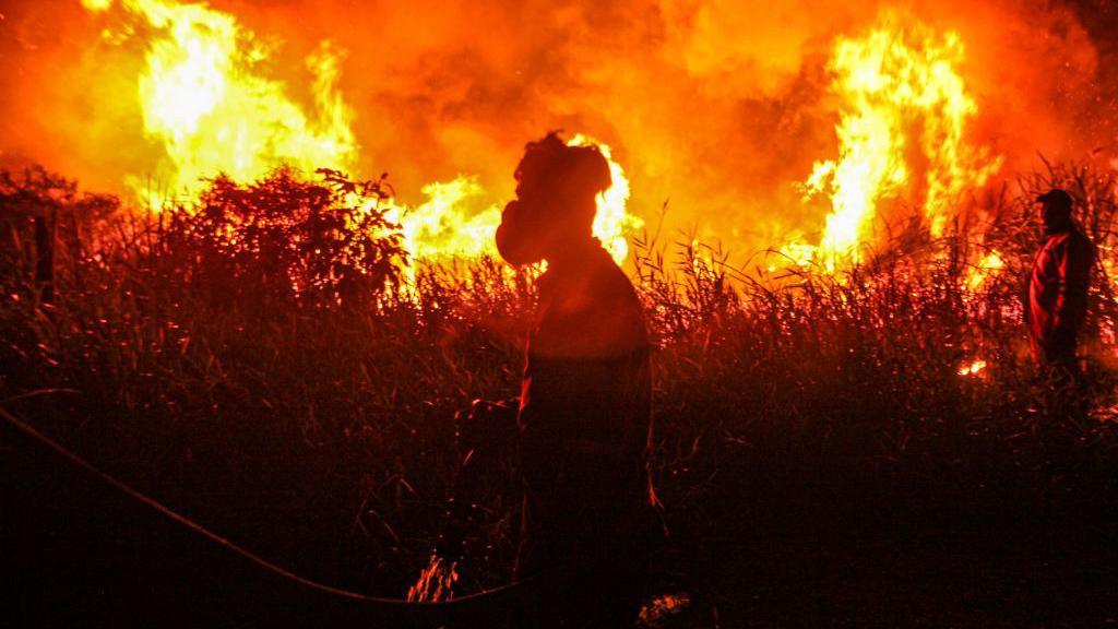
There is also an increased risk of drought and wildfires in parts of Australia, Indonesia, and northern South America, leading to declines in agriculture and global food stocks.
Major flooding struck Peru in 2017 after a strong El Niño brought increased rainfall, isolating communities and neighborhoods.
The closure of the Strait of Hormuz is already disrupting the distribution of fertilizer, leading to increased prices. This will affect harvests in the coming months with a reduced food supply and higher prices.
Prof. Stephens noted that “You’ve got more people that are living in poverty already, and if you get a reduction in crop yields because of drought or flooding [from El Niño], then that drives prices even higher.”
She concluded, “So we’re looking at potentially quite huge humanitarian impacts this year, especially if the crisis in the Middle East continues.”
While the direct impacts on UK weather are less certain, climate scientists at the Met Office suggest that El Niño years are one factor that can increase the risk of colder winters in the UK.
Global forest loss slows but El Niño fires could threaten progress
UN issues new climate warning as El Niño looms