The King Charles III England Coast Path, a new footpath encircling the entirety of England’s coastline, is slated for its official inauguration today.
Stretching an impressive 2,689 miles, this path, according to Natural England, the governmental organization responsible for its creation, is the world’s longest managed coastal walking route.
Formally named the King Charles III England Coast Path, this route marks the first continuous trail of its kind, offering walkers an unprecedented opportunity to explore England’s shoreline step by step.
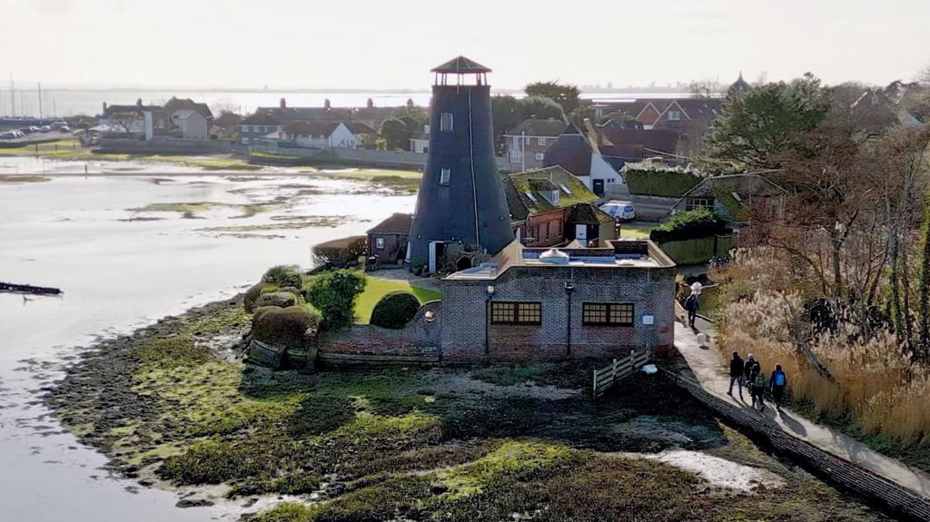
The path traverses a diverse range of England’s most stunning landscapes, encompassing salt marshes, sandy beaches, dramatic cliffs, expansive dunes, and historic coastal towns.
Among the highlights is the iconic chalk downland of the Seven Sisters in East Sussex, which also forms part of a newly designated National Nature Reserve being announced by Natural England.
While significant portions of the coastal route were already in existence, the project involved the creation of over 1,000 miles of new paths and the upgrading of numerous existing sections. These improvements included resurfacing paths, removing stiles, constructing boardwalks, and installing bridges.
Initiated during the government of Gordon Brown, the project has spanned 18 years and seven prime ministers to reach its current stage.
Currently, approximately 80% of the route is open to the public, with the majority of the remaining sections anticipated to be completed by the end of this year.
“It is brilliant – the best thing I’ll do in my working life,” remarks Neil Constable, the project lead for Natural England.
According to Constable, the path’s significance extends beyond its length. Its true value lies in the accessibility it provides, allowing individuals anywhere in England to reach the coast, turn in either direction, and walk alongside the sea for as long as they desire.
The creation of the route necessitated new legislation – the Marine and Coastal Access Act, passed in 2009 – alongside years of meticulous planning and extensive shoreline work to establish a clear and uninterrupted footpath.
Natural England reports that the project has, in many areas, opened up land previously inaccessible to the public, including beaches, dunes, and cliff-tops located between the path and the sea.
Accessibility has been improved for individuals with reduced mobility, enabling a wider range of people to enjoy portions of the trail.
Gaps in the existing network of footpaths have been filled, with an emphasis on bringing the route closer to the water and connecting stretches of coastline that had never before been linked by a single walking trail.
However, in certain locations, walkers may need to briefly deviate from the trail. For example, in north-west England, a ferry across the Mersey River is required to maintain continuity.
One particular section in south Devon presents a unique challenge. At the River Erme, the absence of a bridge or ferry, coupled with private land ownership further upstream, necessitates that walkers wade across the river within an hour of low tide.
“It’s all part of the experience,” says Constable.
The path’s design accounts for the anticipated increase in rainfall and rising sea levels associated with climate change.
English law now includes provisions for the route to be moved inland – a process Natural England refers to as “rolling back” – in response to coastal erosion or shifts.
This adaptability aims to ensure the coastal walk remains continuous and practical for future generations.
Recent events have highlighted the route’s dynamic nature. In early February, a significant portion of the path on the cliffs outside Charmouth in Dorset was lost due to a landslip caused by heavy winter rains.
“The path was closed and a diversion was put in place,” explains Lorna Sherriff, who manages the South West Coast Path, the longest and most challenging section of the new trail.
The diversion added an additional mile and a half to the route and diverted walkers onto roads. Sherriff’s team swiftly coordinated a 15-meter rollback with the landowner, reopening the path within weeks.
“Without this rollback provision in place that would have taken us months,” she says.
The Ramblers charity, a long-time advocate for increased access to England’s coastline since the end of World War II, describes the new path as “transformational,” according to Jack Cornish, director of England for the Ramblers.
“It creates a band of access land from the trail to the high water mark, so that means you can leave the trail to go and roam the beaches,” Cornish says. “You can picnic – and on an island nation you can really enjoy our coast for the first time.”
The route also raises the possibility of a continuous coastal walk around the entire island of Britain.
The new English coast path connects with the Wales Coast Path, an 870-mile route encircling the Welsh coastline. It was completed in 2012 and holds the distinction of being the first path in the world to follow an entire national coastline.
While Scotland lacks a single, officially designated coastal trail, much of its shoreline is accessible due to Scotland’s “right to roam” law passed more than 20 years ago. Estimates of the mainland coastline vary, but it is often cited as approximately 5,500 miles.
A continuous coastal walk around Britain would therefore encompass an estimated 9,000 miles. At an average pace of 15 miles per day, it would require nearly two years to complete, excluding rest days.
For those interested in exploring sections – or perhaps the entirety – of the King Charles III England Coast Path, route maps are available on the National Trails website.
Sign up for our Future Earth newsletter to keep up with the latest climate and environment stories with the BBC’s Justin Rowlatt. Outside the UK? Sign up to our international newsletter here.